Ancient City
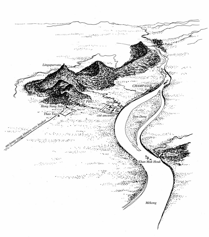
The city measures approximately 2 km x 1.8 km and has a double enclosure of earthen walls. It appears to have been founded around the middle of the 5th century AD, as suggested by an inscription of a king named Devanika, found in the modern village of Vat Luang Kau. Two inscriptions discovered recently in the same area inform us that, as early as the end of the 6th century AD, it was the capital city of king Mahendravarman, who later became the ruler of the Sambor Prei Kuk area (240 km south-west in Cambodia).
Later on, this city (often identified with Shrestapura) lost its role as political capital when the founding dynasties extended their rule over the whole Khmer territory.
They moved their political centers with them finally establishing their capital at Angkor (beginning C.10th). Nevertheless, the successive Khmer rulers never forgot their origins, since most of them, until the last king (Jayavarman VII, end C.12th), established religious foundations in and around Vat Phou.
They made donations for the maintenance of the sanctuary, the religious importance of which was never denied. Afterwards, Vat Phou became an active Buddhist sanctuary, and remains so today: every year, at the time of the February full moon, a pilgrimage is held which attracts many worshippers.


